
Lompoc ZIP Codes, Three Postal Roles
Lompoc's postal area uses three ZIP codes with different geographic roles. ZIP 93436 is the main geographic delivery area and reaches beyond the incorporated city. ZIP 93437 identifies Vandenberg Space Force Base and a coastal federal installation. ZIP 93438 is a non-geographic, post-office box role. USPS groups the destination under Lompoc, but the postal city does not settle the parcel's jurisdiction.
The coverage table is the core of the Lompoc ZIP code directory. It says what a ZIP can suggest, what it cannot prove, and which next check is needed.
| ZIP code | Areas or character | Post office | Notes |
|---|---|---|---|
| 93436 | Main Lompoc delivery area; Mission Hills, Vandenberg Village, and rural valley addresses | Lompoc Post Office | Geographic ZIP; extends beyond city limits |
| 93437 | Vandenberg Space Force Base and coastal federal installation | USPS groups destination under Lompoc | Postal Lompoc does not mean incorporated Lompoc |
| 93438 | Lompoc post-office box and non-geographic mail | Lompoc Post Office | Verify box or service assignment for each recipient |
A ZIP result narrows geography. It does not name a household or select a county, city, federal, or state record system by itself.
Note: Postal geography is a starting clue; the parcel, jurisdiction, and record custodian supply the stronger location link.
93436 Beyond Incorporated Lompoc
ZIP 93436 covers the main Lompoc delivery area, but the research specifically includes Mission Hills, Vandenberg Village, and rural valley addresses. Those places may carry a Lompoc postal label while falling outside the incorporated city. A city permit or planning question should therefore begin with the parcel and jurisdiction returned by GIS, not only the ZIP printed on an envelope.
Use the USPS address lookup to verify the delivery ZIP. Then open Lompoc Find My Zoning for a city address or the county parcel maps for a county route. The assessor can supply a situs, APN, transfer, and improvement facts, but the public card has no ZIP filter.
When a ZIP search produces multiple jurisdictions, record the postal city, incorporated status, county, and parcel APN as separate fields. That small table prevents a postal label from sending a request to the wrong office.
93437 and Vandenberg Space Force Base
ZIP 93437 serves Vandenberg Space Force Base and the associated coastal federal installation. A base address can use Lompoc as its postal destination while its records, public maps, and institutional contacts sit in a federal or base-specific system. The ZIP code directory should identify that distinction before a resident question becomes a county assumption.
Use USPS for delivery validation, then decide whether the question concerns a county parcel, a city address, or a federal installation. A base or unit history can support historical research, but it is not a public service-member roster. Keep public unit history separate from private personnel information.
A ZIP code is a delivery construct. It is not an ownership record, voter boundary, census place, or guarantee that an address lies within city limits.
93438 and Lompoc Post-Office Mail
ZIP 93438 is the Lompoc post-office, non-geographic role in the research. It can identify a box or mail-service assignment rather than a mapped household location. Verify the specific service and recipient through USPS before using the ZIP as a geographic clue.
The Lompoc Post Office is listed at 801 W Ocean Avenue, with phone 805-736-8744. Published retail hours are Monday through Friday, 10:00 a.m. to 5:00 p.m., and Saturday, 10:00 a.m. to 2:00 p.m.; the facility also lists a kiosk, lot parking, carrier, and general delivery. The facility record is a postal-service fact, not a resident directory.
The official post-office image below is linked to the USPS facility page. Review Lompoc Post Office details before relying on a retail or service detail.
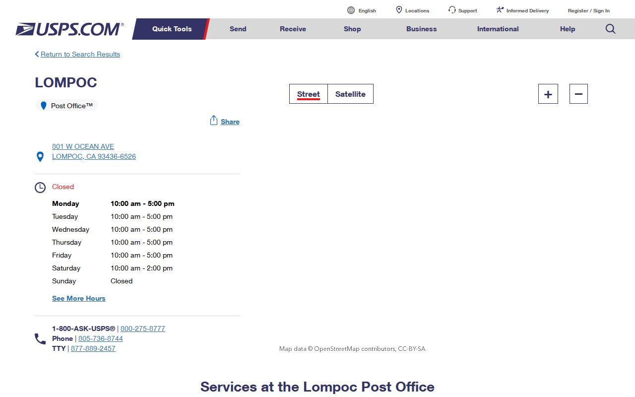
The facility supplies mail-service context. It does not turn a box ZIP into a mapped block or household list.
Note: A non-geographic ZIP can route mail without identifying a parcel, so verify the service assignment before mapping it.
Narrow a Lompoc ZIP Resident Search
Official tools do not provide a single ZIP-wide resident search. Build a validated address set first, then move from ZIP to parcel, street, document, or record category. The sequence below keeps postal geography and resident evidence separate.
- Enter the complete address into USPS ZIP lookup and save the returned ZIP, city, and state spelling.
- Use city Find My Zoning or county Parcel Maps to establish jurisdiction and, where available, the parcel polygon.
- Search the assessor by APN, house number, unit, and street without a suffix; record the situs and parcel facts.
- Follow a transfer document into the recorder or use the relevant court, vital, license, business, or library source.
- For a whole ZIP question, describe the verified address set and request only an existing, identifiable, nonexempt record from its custodian.
Once a ZIP narrows to a street, use the Lompoc by-street address workflow. It owns the parcel-by-parcel chain that a ZIP code cannot provide.
USPS Verification for Lompoc Addresses
The USPS address lookup verifies a delivery ZIP from the full address. That matters because postal names can cover Mission Hills, Vandenberg Village, rural valley parcels, and federal areas. It also prevents a directory search from relying on a guessed ZIP from a partial street string.
The USPS lookup image below is linked to the official form. Verify a Lompoc ZIP code by address and retain the exact return for the search log.
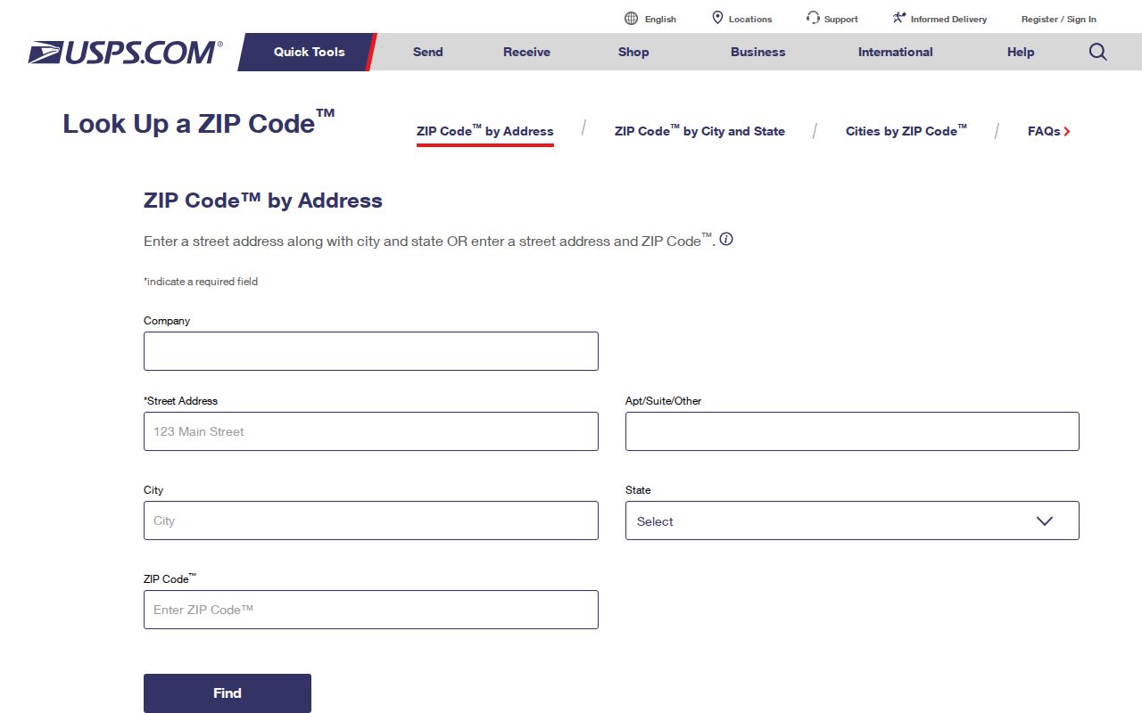
The image shows the verification route, not a complete list of people in a ZIP. Use the returned address and postal city as one geography field, then select a record custodian separately.
ZIP+4 can refine delivery within a route, but it does not create a public resident list. A carrier route is an operational delivery path. Census ZCTAs are statistical approximations built from census blocks and should not be substituted for USPS or city GIS when routing an individual record.
Why Lompoc Portals Do Not Search ZIP-Wide
The assessor accepts APN, house number, unit, and street name, but no ZIP field. The recorder searches name, document, map, date, and legal clues. My Voter Status is identity-gated, and a voter file requires a qualified purpose. Lompoc GIS begins with an address and parcel layer. These designs explain why a ZIP code directory cannot honestly promise a ZIP-wide name result.
The assessor field table is the practical test. It can browse a street after a ZIP has been converted into validated addresses, but the ZIP itself is not a searchable resident key.
| Portal field | Available? | What to do for a ZIP question |
|---|---|---|
| Parcel Number | Yes | Use an APN to reach parcel detail and a transfer document. |
| House Number | Yes | Pair with street name for a specific address. |
| Unit | Optional | Use when the parcel record has a unit field. |
| Street Name | Yes, suffix-free | Browse and paginate a validated ZIP address set. |
| ZIP code | No | Verify through USPS, then search each address or parcel. |
| Sort | Parcel number or street | Use street sort to keep the address list ordered. |
A field that is absent is a finding. It is better to state the local search limit than to imply that a portal can produce data it does not accept.
[RESEARCH GAP: The manifest has no successful ZIP-capable assessor or GIS screenshot. Verify a current portal view after the USPS address check.]
Note: The assessor's missing ZIP field is a portal limit, not evidence that a ZIP-wide resident roll exists elsewhere.
Lompoc ZIP Boundaries Versus City Lines
A ZIP boundary, incorporated city line, county parcel, Census ZCTA, and federal installation boundary answer different geography questions. ZIP 93436 can carry a Lompoc mailing label beyond the city. ZIP 93437 identifies the base area. ZIP 93438 is non-geographic. Use the city GIS or county parcel map to decide whether a record belongs to Lompoc, Santa Barbara County, a federal custodian, or another local jurisdiction.
- ZIP code
- A USPS delivery geography that can cross municipal boundaries.
- ZIP+4
- An added delivery segment that refines routing; it is not a resident directory.
- PO-box ZIP
- A non-geographic postal assignment tied to box or service delivery.
- Unique ZIP
- A ZIP assigned to a single institution or large delivery point, where the postal system defines it that way.
- Carrier route
- An operational delivery path within the postal system.
The definitions keep a ZIP code directory from overclaiming. A postal label can be a useful first clue, but jurisdiction and parcel evidence control the records route.
Burton Ranch Without a ZIP Rewrite Claim
Burton Ranch Annexation No. 70 became effective May 31, 2007. Its specific plan took effect October 5, 2007 and was amended February 6, 2024. The annexation is a city-boundary fact, not evidence that a postal ZIP was split or realigned. The research found no official ZIP split or general street-renumbering year.
When an address appears on an older map, compare the current USPS result, city or county GIS jurisdiction, APN, and legal description. A modern city boundary can include land that an earlier municipal map did not, while the postal destination may remain the same. Do not infer a boundary change from a ZIP label alone.
Build a Lompoc ZIP Directory Carefully
A useful ZIP code directory entry has five parts: the verified address, USPS ZIP, postal city, actual jurisdiction, and the record source chosen next. Add the date checked. For an address-level question, route to assessor and GIS. For a past household, use directories, census, newspapers, maps, and the county chain. For a state record, use the state custodian. For a federal or base question, do not force the record into a city category.
The postal story is part of Lompoc's local record geography. Ocean Avenue is the modern east-west spine, streets carry N/S directions, and North H Street or SR 1 is a principal corridor. The historic 1874 street framework helps compare old sources, but precise house-number formulas and address assignment authority were not verified. Confirm a new or changed address with Lompoc Planning or Building inside city limits, or county Planning and GIS for an unincorporated parcel.
Best practice. Verify the ZIP from the full address, select the jurisdiction from GIS, and let the record custodian define what a name or address result means.
That sequence keeps the Lompoc ZIP code directory useful without pretending that postal geography is a complete resident roll.
Note: Burton Ranch changed municipal geography, but the research does not establish a corresponding ZIP split or realignment.